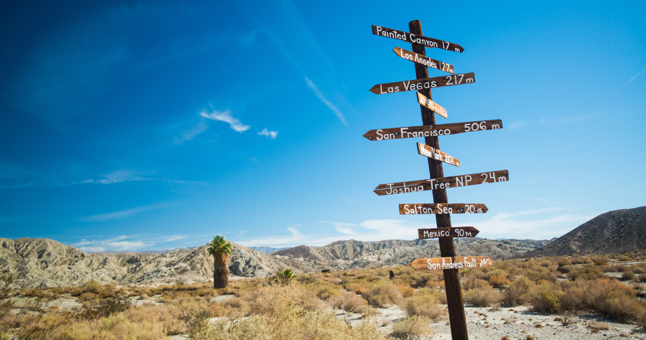
Joshua Tree National Park, Death Valley, palm oases, sand dunes... Around Palm Springs, the vastness and diversity of the landscape are a constant call to put on your hiking boots. The trails are endless and the mountain ridges that rise up between the deserts of California invite you to run to the top. After having hiked some of them, here are some trails that we have referenced to reconcile hiking and scenic beauty.
1) Mosaic Canyon Trail
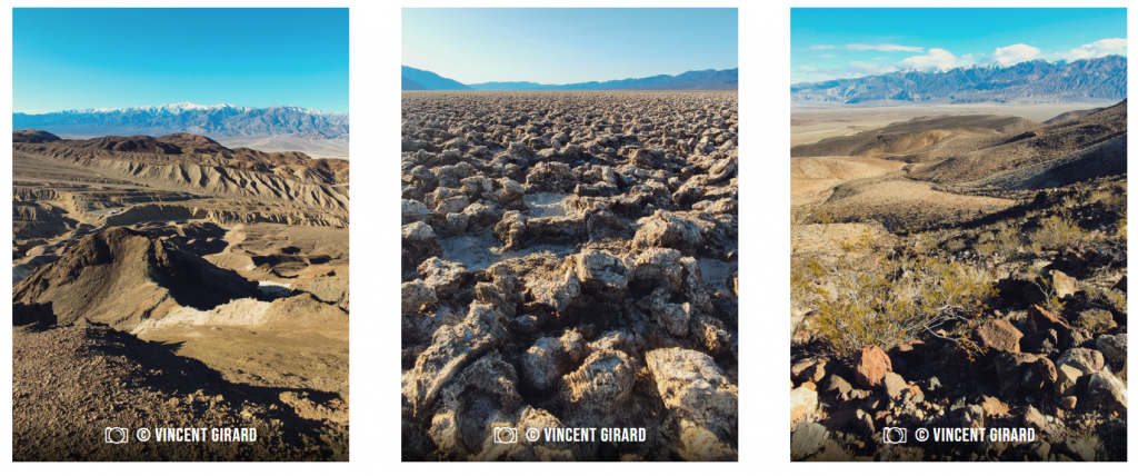
About 450 km northwest of Los Angeles, Death Valley is the largest national park in the United States after Alaska with an area of 13,650 km². It is larger than the region of Ile-de-France. The rock formations mark out the immensity of this park that we contemplate via the 1 609 kilometers of paved roads and 4×4 trails that cross it. Protected from bad weather by the Sierra Nevada mountain range, Death Valley extends entirely over the Mojave Desert.
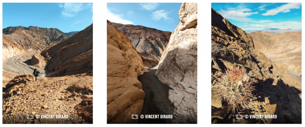
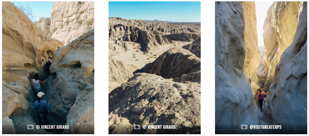
Located almost two hours' drive from the town of Ridgecrest, the Mosaic Canyon Trail is a 6.4-mile round-trip hike if you do it all the way. A road provides access to the beginning of the canyon and allows you to park your vehicle before beginning the hike. At a time when rain was still falling heavily in this part of California, a canyon was formed and you enjoy walking through its geological curves formed millions of years ago. The striations and stripes of the rock offer multiple colors (hence the name Mosaic Canyon). If it is possible to make the hike by staying on the relatively flat part of the bottom of the canyon, singles appear on the sides as soon as one starts to climb a little. What to give another perspective of the place and to decorate the walk of a little bit of unevenness.
Gradually, you go deeper into the canyon which narrows in places and then widens. You should not hesitate to make your way even when the area becomes narrow to reach the furthest point before coming back on your steps. In total, the difference in altitude shows a little more than 350 m of D+ by the classic passage at the bottom of the canyon, but you are free to aim for a higher point on the mountain to make the hike more sportive. The rock is particularly abrasive and the view is always clear thanks to the absence of trees which makes it easier to find your way and avoid venturing too far, always having the canyon as a reference point.
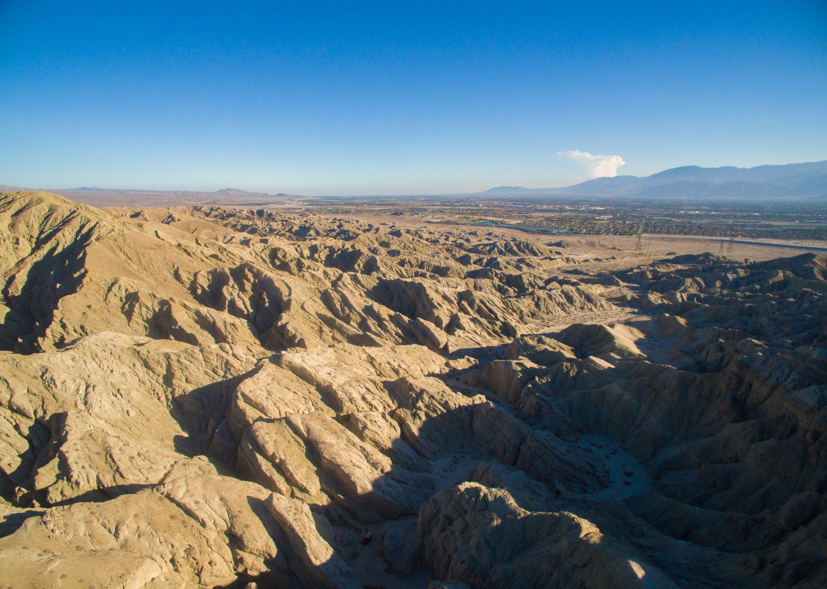
2) Zabriskie Point / Golden Canyon
Moving further east, we approach the Nevada border. For many, Zabriskie Point is first and foremost Michelangelo Antonioni's film released in 1970 in an America then marked by the Vietnam War and student protests on college campuses. In this production of the Italian director, the two heroes Mark and Daria find themselves at Zabriskie Point in Death Valley.
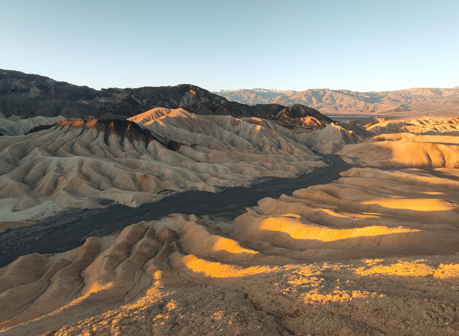
This spot is located 7 km from the town of Furnace Creek and is considered one of the most beautiful viewpoints in the area, especially at sunrise and sunset. A short, paved road that can only be used on foot leads to the viewpoint and offers a fascinating view of the geological formations and the different forms of erosion of the mountains. Most visitors wait for the sun to appear or disappear to contemplate and immortalize the different colors of the mountains as the light changes.
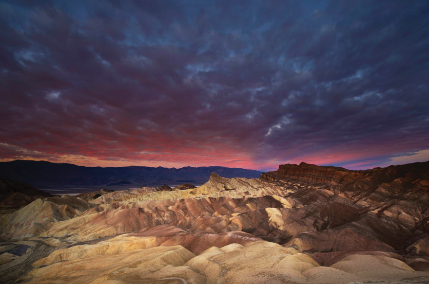
To hike in this area, you need to descend into the canyon and take advantage of three well-marked trails: Golden Canyon to Red Cathedral (4.8 km), Gower Gulch Loop (6.9 km) and Badland Loop (4.3 km). If you plan your GPS track in advance, you'll have no trouble linking the three trails, since the gradient is moderate (between 200 and 300 m D+ for each trail) and you'll be able to take advantage of the well-marked singles on ridges and cliffsides. As always in Californian deserts, this is an exposed area, and even in winter you'll need to bring plenty of water with you, especially if you're planning to cross this small massif from Badwater Road to the Zabriskie Point parking lot.
3) California Riding and Hiking Trail / Joshua Tree National Park
The entrance to Joshua Tree National Park is 225 km from Los Angeles and 30 km north of Palm Springs. It is highly recommended to visit one of the park's Visitor Centers (Joshua Tree, Oasis, Cottonwood and Black Rock Nature Center), as is the case in most American national parks. This is an opportunity to ask the rangers about road conditions, potential trail closures and recommended hikes. This is also where you can buy some souvenirs and sometimes discover exhibitions about the park.
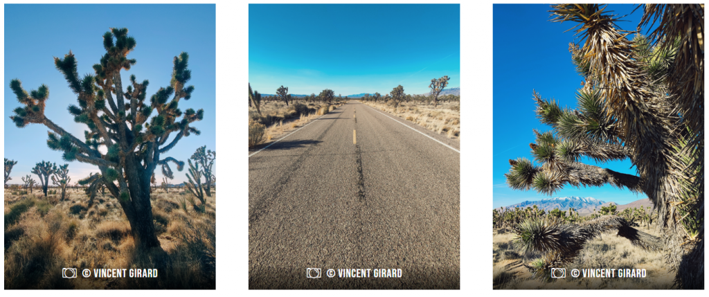
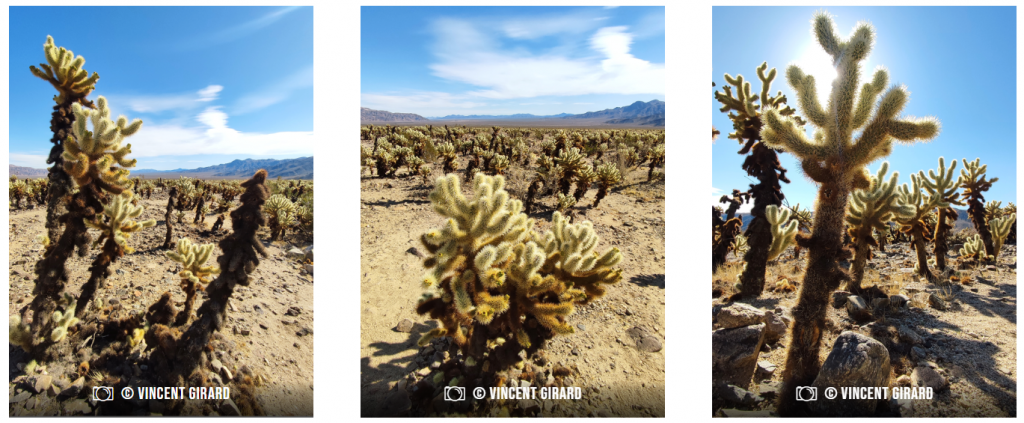
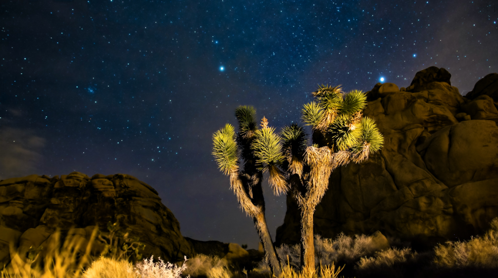
Joshua Tree National Park takes its name from the Joshua tree (photos above). This species of yucca flourishes in this part of the Mojave Desert. Entire valleys are filled with this tree and cactus and form a fascinating landscape. In the park, one is also amazed by the geological formations in the middle of the desert. Bare rock hills, separated from each other and emerging like majestic sand castles.
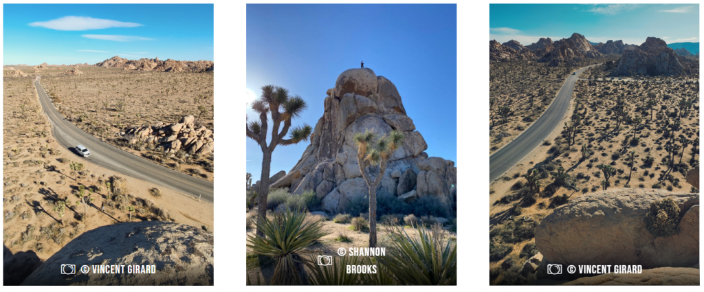
Hikes are plentiful in the area, and the best known is probably Skull Rock (located at the Twenty Nine Palms entrance), named for a skull-shaped rock along the trail. But with 2.7 km of distance and an easy access spot just off the road, the place can quickly become overrun with walkers and transients, especially in high season. On the other side of the road, it's immediately quieter and trails like Split Rock Loop Trail (3.2 km) or Split Rock Connector (4.8 km) allow for variety.
For the more motivated and organized, the California Riding and Hiking Trail (CRHT) offers a route of around 60 km with a reasonable vertical drop of 1,573 m D+. This trail is not a loop, so you'll need to plan a shuttle to get back to your starting point, while managing the water you take with you, especially if you do this outing over two or three days, as the rangers advise. Finally, Joshua Tree National Park boasts ten mountain peaks rising to over 2,000 metres in altitude. Enough to satiate even the most enduring hikers, and allow you to enjoy panoramic views over the Coachella Valley.
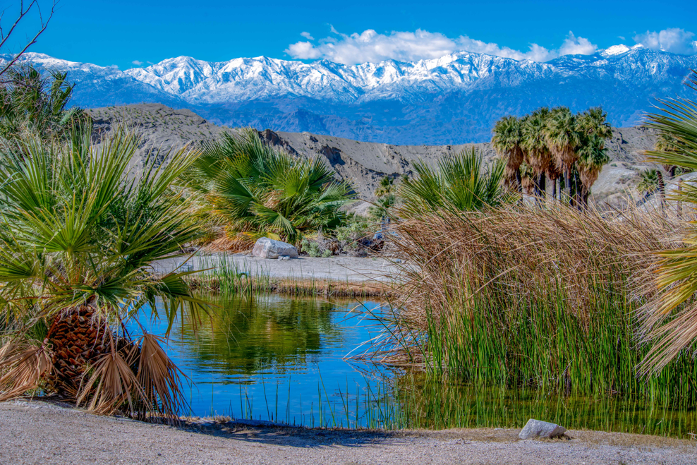
Bonus: Oasis, dunes and San Andreas fault
Some of the oases near Palm Springs can be visited by Jeep, such as Metate Ranch, which offers to take you by 4×4 to a private mountain area before starting a hike, guided by a local ranger. After paying for your Jeep tour, you'll be able to walk through a beautiful oasis where the trunks of the skirted palms are overgrown with their ancient leaves. Near Palm Springs, several oases can be seen in Andreas Canyon, Murray Canyon and Palm Canyon. In Joshua Tree National Park, there are a total of five lush oases that can be visited in one day.
In addition to these green spots in this arid setting, you can also walk the desert badlands formed by the geological San Andreas Fault. The mountains were created here by the junction of the Pacific and North American tectonic plates. This fault is the cause of more than 200 earthquakes per year felt by humans in California.
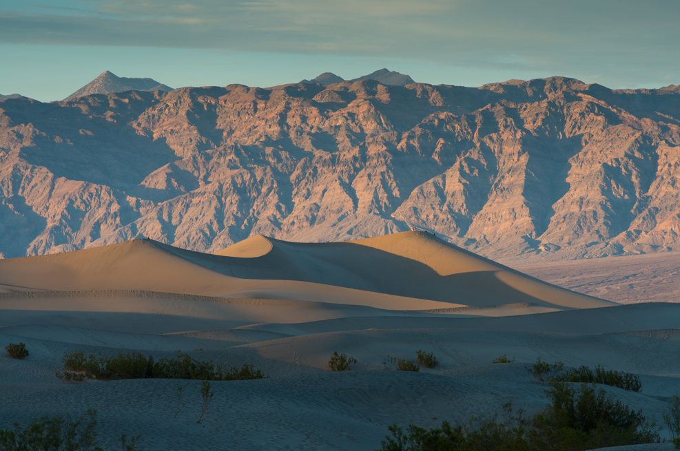
Finally, desert often means dunes. And this is the case in California, even if the appearance of dunes comes as a surprise when you arrive in Death Valley at Mesquite Flat Sand Dunes. Here, wind and erosion have worn away the surrounding mountains, depositing grains of sand in the valley over the millennia. These have been blocked by massifs to the south, creating these astonishing sand dunes, up to 30 metres high. Of course, there are no marked footpaths in this area, as the sand and wind quickly erase every trace of footfall. And as we all know, running in the desert is a real challenge as you sink so deep into the sand. But the effort is rewarded at the top of the Mesquite dunes by a view of this magnificent area and by crazy runs once you've launched yourself up the slope. Yet another pleasure offered by California and its deserts.
Practical information :
In which season to go ? Avoid the hottest months in the summer when temperatures exceed 40 degrees and make hiking and trail riding more difficult. The highest temperature in history was recorded in Death Valley on July 10, 1913 with 56.7°C. In 2020 and 2021, meteorologists have noted temperatures of 54°C. But between November and March, the climate is much milder and allows hiking in ideal conditions.
How to get to Palm Springs? Air Tahiti Nui offers daily flights on the Paris/Los Angeles route. It takes 1h30 to 2h30 by car (depending on traffic conditions) to get from Los Angeles to Palm Springs. This city also has an airport (Palm Springs International Airport).
How much does it cost to enter a park? A special feature of the country is that you need a pass to visit one of the 61 national parks in the country. You can buy your ticket directly at the park entrance ($30 for Death Valley, for example) or opt for an $80 annual pass that will allow you to visit all the American national parks.
Where to sleep in the parks? If you're looking for comfort, the services offered by the ranches you'll find along the way are of a high standard, such as those offered by The Ranch at Death Valley or The Oasis at Death Valley. Camping in American parks is much more regulated than in France. Before you pitch your tent, make sure you're in an authorized zone, like the one just around the corner from the Skull Rock and Jumbo Rock trails in Joshua Tree National Park. You'll need a permit (most of which you'll have to pay for) to sleep there. Finally, why not opt for a night in an Airstream, one of the country's typical aluminum caravans. Some, like AutoCamp in Joshua Tree, offer all the comforts you need.
Find all the trails around Palm Springs on this interactive mappractical information about the California deserts in this addressas well as ideas for hiking on the Palm Springs site.
Vincent Girard 31/01/23