In order to take advantage of the mild temperatures of Southern Europe, let's go to Spain with these three hikes to discover the trails of the Iberian Peninsula and the Canary Islands.
1 : El Cinquè Llac
Centenary trees, secret monasteries, shepherd's paths... The path of El Cinquè Llac (the fifth lake in French) is located in the Terres de Lleida in Catalonia. In the middle mountains of the Pyrenees, it is a 105 km hike and a little more than 5,000 meters of positive altitude difference that awaits you if you attempt it in its entirety. In general, it takes five days to see the end of it.
Among the peaks that you will pass are those of Peracalç, the Serreta Pass and the Eagle Peak, while the walled city of Peramea is a must-see, where you should not miss the Romanesque church of Sant Cristòfol, the Colomers Tower or the Era de Ortega cultural center. The mysterious monastery of Torres, the ghostly village of La Bastida or the impressive Devil's Bridge are other places that you will visit as you walk along this path of El Cinquè Llac.
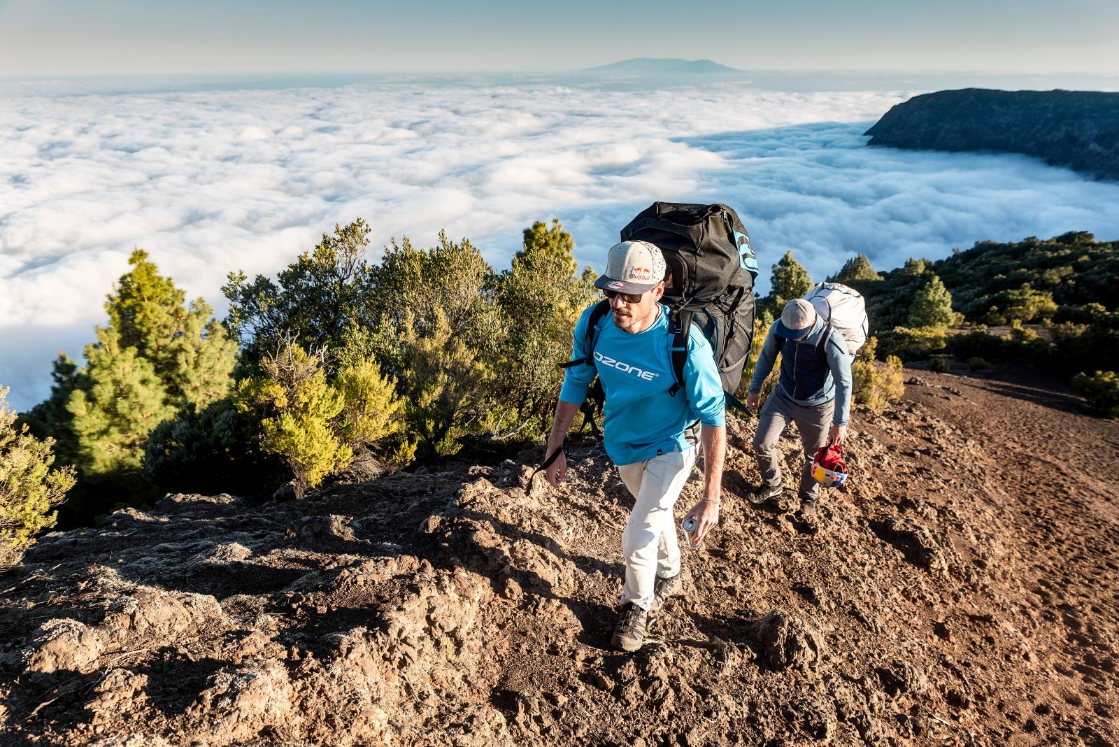
2 : Great crossing of Tenerife
Located in the Canary Islands off the coast of Morocco, the island of Tenerife offers a lunar landscape for hikers. It's the training ground for many professional road bike teams, for its year-round optimal temperatures and for the island's steep climbs. When it comes to hiking, the choice is wide. The "Grande traversée de Tenerife" (also known as "Latitud Tenerife") is usually completed in seven days and covers just over 110 km. Of course, it's also possible to do just one day's walking on either section of this route, which totals 5,400 meters of ascent and descent.
September and October are the perfect months to attempt the entire crossing, which offers a variety of landscapes. From coast to volcanic desert, the Grande Traversée de Tenerife also passes at the foot of the Teide (3,715 m) and Pico Viejo (3,135 m) volcanoes. Le Teide is the highest peak in Spain and the third highest volcano in the world. Also on the program are the rock formations of las Catedrales and los Roques de García, emblematic of Teide National Park. As for the "Corona forestal", its Canary pines will provide welcome shade during your forest walk.
3 : Crossing Asturias
From the Atlantic coast in northern Spain, this trail crosses the Asturias region from north to south, on its way to the city of León. It takes six days to complete this itinerary of just over 100 km and 3100 metres of positive ascent. The Route de la Cares, also known as "The Divine Gorge", takes you along a path carved out of the limestone along the River Cares. A long section of the route through Asturias follows the GR100. But it's best to have a precise map of the area with you, or a GPS where you can follow a trail, as the signs on this route are not always well maintained.
In Asturias, it is also common to come across hikers on their way to Santiago de Compostela. A second itinerary, the Camino del Norte, passes through the region. This runs along the ocean and Atlantic coast of northern Spain. It is more technical and athletic than the route more commonly taken by pilgrims to the south (the much-traveled Camino Francés). In Asturias, it's also an opportunity to admire the fabulous peaks of Europe. This massif is the highest in the Cantabrian mountain range and lies between the provinces of Asturias, León and Cantabria, some 30 km from the sea. Its highest point is Torre de Cerredo, at 2,649 meters above sea level.