At the beginning of July in the Hautes-Alpes and Italy, "La Tournée des Grands Cols" enabled many cyclists to enjoy climbs reserved for bikes. We Rock Sport was on hand to swallow as much D+ as possible. The first part of our article on Piedmont's transalpine passes.
Take on the role of a Tour de France rider for a morning on the legendary Tour de France passes, closed to cars for the occasion. That's the idea behind the Grand Cols TourThis year's edition of the Alpine Bike Challenge will feature routes on both sides of the Alps in France and Italy. In June, our transalpine friends opened the ball with the Colle Fauniera and the Pian del Re. For our part, it was with the Col de Sampeyre that we began our five-day, D+-loaded tour, while discovering the beauties of the Queyras and the link between Europe's highest inhabited valleys and their Italian neighbors.
- Col de Sampeyre
Where are we?
Welcome to the Piedmont region on this ascent from Sampeyre in the Valle Varaita to Stroppo in the Val Maira. Located in the province of Cuneo, this pass is accessible from France via the Col Agnel (1h30 drive from Guillestre to the foot of the pass).
How difficult can it be?
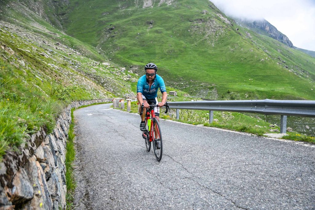
The Col de Sampeyre is 15.8 km long and has a total vertical drop of 1313 metres. It's a fine piece of climbing that was on the Giro d'Italia program in 1995 and 2003. The climb is long, so you'll need to take it easy to reach the summit at 2284 metres. The average gradient is 7.5%, with passages at 15 %. The meeting point for participants is Stroppo, in the hamlet of Paschero. The road will be closed to motorized traffic in the hamlet of San Martino (elevation gain 916 m and 9.40 km).
How did it go?
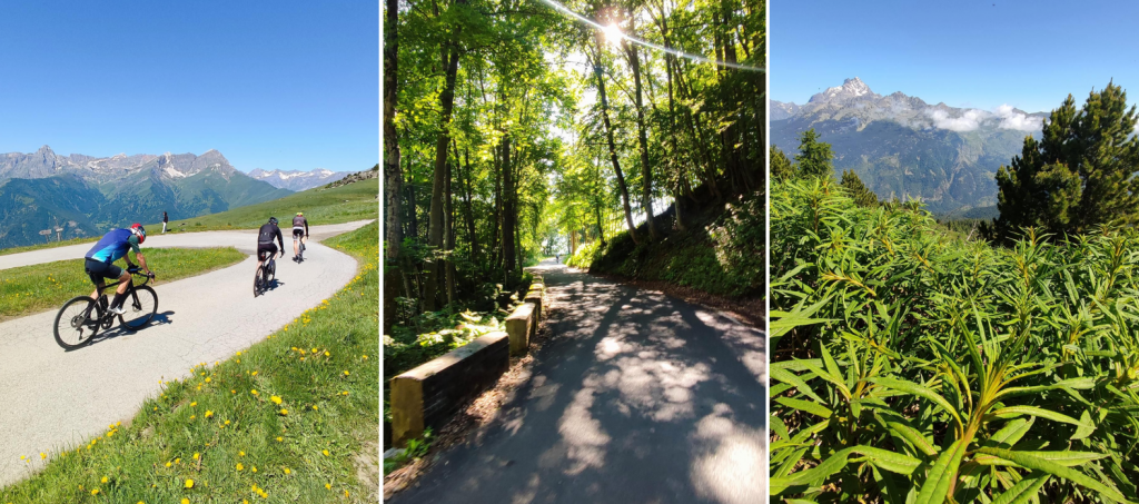
The climb begins in the town of Sampeyre, at an altitude of 976 metres. On July 4, before attacking the first slopes, members of the local tourist offices are on hand to give a small frame plate to each two-wheeler about to make the ascent. A welcome initiative for cyclists, who appreciate keeping them as souvenirs. A document was also signed to record all the cyclists who had come that morning to take advantage of the exceptional closure of the pass to cars. The first part of the route is shaded by trees. That's a good thing when you've got to start pedaling in the heat of summer. The pleasure of being able to ride without the noise of cars or motorcycles, while sometimes cutting corners generously without the apprehension of seeing an oncoming vehicle, is in itself worth the effort of taking part in the Grand Tour. The silence is disturbed only by the conversations we have with cyclists we meet along the way.
The percentages remain serious throughout the climb, and there's hardly anywhere to take a breather, especially in the middle of the pass where the highest percentages are reached. As for the crowds, they remain reasonable, and we'll realize a few days later that there will be far more cyclists on the French climbs of this Tournée des Grands Cols. As the forest gradually disappears, you can enjoy the scenery, and in particular the sublime view of Mont Viso, the emblematic peak of the Italian Alps at 3,841 m altitude. As for the road surface, it could do with a little resurfacing, for while it poses no problems on the way up, the descent is a little more complicated, with a few shaky spots. At the summit, a basic refreshment (tarts and water) awaits us. A photographer is on hand to immortalize the moment, as will be the case on all the Tour's passes.
What do we do after cycling?
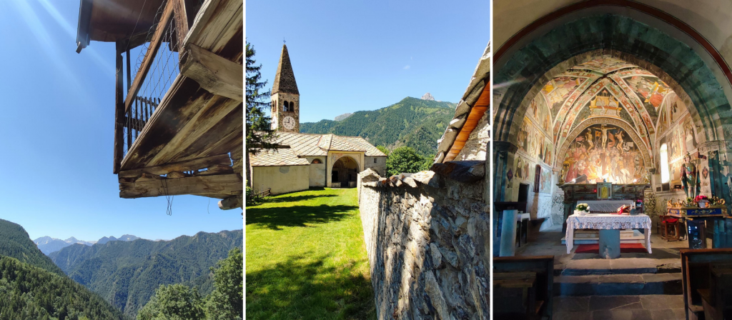
Once you've reached the summit, we recommend you descend a little less than 10 kilometers to Elva, a charming little village in the province of Cuneo at an altitude of 1,637 meters, made up of 29 small hamlets scattered across the Valle Maira. The church of Santa Maria d'Elva, with its frescoes by Flemish painter Hans Clemer and its Gothic bell tower, is well worth a visit. Strolling through the village, you'll also come across the astonishing Museo di Pels (Hair Museum), which tells the story of the hair-gathering trade, widely practiced in this locality at a time when this raw material was essential for making wigs. As for restaurants, the 70-seat Locanda di Elva welcomes guests and serves generous traditional Italian cuisine.
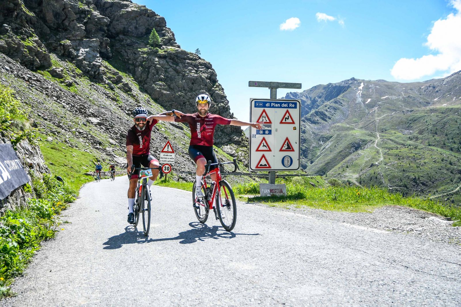
- Pian del Re pass
Where are we?
We're still in the Italian Piedmont for this pass, located some ten kilometers as the crow flies from the Sampeyre pass mentioned above. But from one valley to the other, it takes 1h30 by car and 70 km to go from Sampeyre to Pian del Re. At the summit, you're less than two kilometers from the Franco-Italian border.
How difficult can it be?
Here, too, cyclists are faced with a beautiful climb of 1,366 meters of positive vertical drop. The 19-kilometer climb takes you up to an altitude of 2,020 meters, with an average gradient of 7.2% and passages of 12% on the most demanding sections.
How did it go?
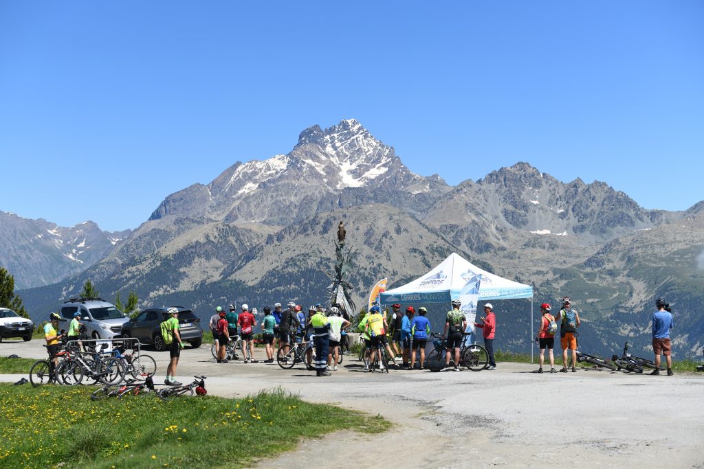
There was a change in the weather that day, as we tackled this pass hidden in the clouds, which we couldn't see from our departure from Saluzzo. This town of just under 20,000 inhabitants is a perfect rallying point for cyclists, and has all the amenities you need to ride your two-wheeler up into the hills. Saluzzo is some 40 km from the top of the pass. The gradients are very gradual and car traffic becomes less and less dense as you go up. The pass was closed to cars that day from Crissolo, near the Sala delle Guide. This left 9 km and 690 D+ to cover to the Pian del Re refuge, where the road ends. As on the Col de Sampeyre, the asphalt leaves something to be desired on some sections, and care must be taken when descending.
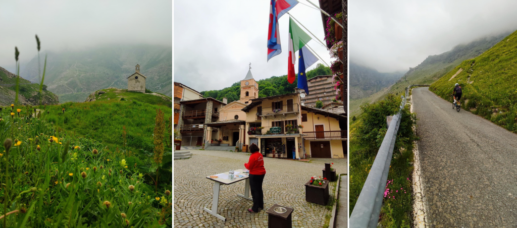
As in 1991 and 1992, when the Giro d'Italia climbed this pass two years in a row, fog is also present, and we can expect to encounter this kind of condition often. All along the climb, we skirt the hamlets of Serre, Borgo and Serre Uberto, winding our way between deciduous trees and pastures. The landscape is rugged and imposing, as is the length of this pass. We also skirt the sources of the Po, Italy's longest river, heading on the final stretch to the Pian del Re peat bog. At the summit, the peacefulness of the place (in the shape of a cul-de-sac, except for walkers who can continue to the border) allows you to appreciate the environment at 2000 metres altitude. Then it's downhill and back to Saluzzo. This is an opportunity to brush up against speed records (85 km/h on our side) on the final straight stretch, which benefits from a road resurfaced two years ago.
See this post on Instagram
What do we do after cycling?
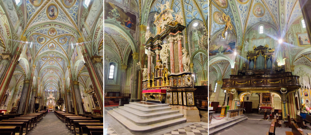
The Cathedral of Our Lady of the Assumption, enthroned in the center of Saluzzo, is not to be missed. With its red brick and plaster facade, it's hard to miss. But it's above all its interior architecture that makes this 15th-century church a must-see if you're in the area. Comprising three naves, several secondary altars and remarkable works of art, it makes a statement with its rich decorations filling the ceiling and every column in the building. The organ is magnificent, as is the altar with its eleven wooden statues.
For more information on the Tournée des Grands Cols, go to Queyras tourist office website.